Light Pollution Map-VRs Travel
Light Pollution Map-VRs Travel is #174 in Travel Paid in United Arab Emirates and charting in 1 of 24 countries we track.
Updated 27 Sep 2026 · rankings refresh through the day
DeveloperTigran Mkhitaryan
CategoryTravel
Price22.99 AED
Released
Rating★ 0.0 (0)
Version1.0
Age rating4+
First seen by us 25 Sep 2026
25 Sep 2026Rating
0.0 ★
0 ratings
Measured
Best rank now
#174
Travel PaidMeasured
Light Pollution Map-VRs Travel on the App Store
App details
App ID
6463651898
Publisher
Tigran Mkhitaryan
Content rating
4+
Where it ranks now
Every top chart it appears in across 24 countries.
| Country | Charts | Rank |
|---|---|---|
| United Arab Emirates | TravelPaid | #174 |
Apps near Light Pollution Map-VRs Travel on the chart
Travel Paid, around #174.








Ratings
App Store, worldwide.
Rating
0.0 ★
0 ratings
Measured
Ratings
0
Measured
About Light Pollution Map-VRs Travel
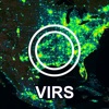
Light Pollution Map is an essential tool for travelers and outdoor enthusiasts who find themselves in remote areas. With data from the Visible Infrared Imaging Radiometer Suite, the app provides a detailed map of light pollution levels in any location.
Designed originally for military use, Light Pollution Map allows you to navigate by finding a point of light in the distance. If you ever get lost , this app will guide you towards a source of light, giving you a better sense of direction and a greater chance of finding your way back to civilization.
Whether you're hiking, camping, or just exploring the great outdoors, Light Pollution Map will help you stay safe and avoid getting lost. It's an essential tool for anyone who loves to explore off the beaten path.
Features:
Accurate map of light pollution levels in any location
Easy-to-use interface for quick navigation
Designed for military and outdoor use
Helps you find your way in the dark
Free to download and use
The data is from the Visible Infrared Imaging Radiometer Suite (VIIRS) instrument aboard the NASA/NOAA satellite, as captured in 2022.
Note that these instruments are not sensitive to white light from LED's, now commonly used in street lights.
Designed originally for military use, Light Pollution Map allows you to navigate by finding a point of light in the distance. If you ever get lost , this app will guide you towards a source of light, giving you a better sense of direction and a greater chance of finding your way back to civilization.
Whether you're hiking, camping, or just exploring the great outdoors, Light Pollution Map will help you stay safe and avoid getting lost. It's an essential tool for anyone who loves to explore off the beaten path.
Features:
Accurate map of light pollution levels in any location
Easy-to-use interface for quick navigation
Designed for military and outdoor use
Helps you find your way in the dark
Free to download and use
The data is from the Visible Infrared Imaging Radiometer Suite (VIIRS) instrument aboard the NASA/NOAA satellite, as captured in 2022.
Note that these instruments are not sensitive to white light from LED's, now commonly used in street lights.
Latest updates
1.0