Tokyo Jisou Maps
東京時層地図
Not in any tracked top chart right now.
Updated 27 Sep 2026 · rankings refresh through the day
DeveloperJapan Map Center, Inc.
CategoryNavigation
PriceFree
Released
Rating★ 2.3 (3)
Version1.0.2
Age rating4+
First seen by us 25 Sep 2026
25 Sep 2026Rating
2.3 ★
3 ratings
Measured
Tokyo Jisou Maps on the App Store
App details
App ID
6751535809
Publisher
Japan Map Center, Inc.
Minimum OS
iOS 17.6+
Content rating
4+
Languages
2
EN JA
Size
11 MB
Where it ranks now
Every top chart it appears in across 24 countries.
| Country | Charts | Rank |
|---|---|---|
| Not charting right now. | ||
Ratings
App Store, worldwide.
Rating
2.3 ★
3 ratings
Measured
Ratings
3
Measured
About Tokyo Jisou Maps
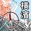
The "Tokyo Jisou Maps" is a map application that allows you to learn about the changes in the Tokyo region, based on the time axis from the Meiji era to the present day.
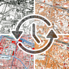
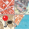
From the Meiji era (1868-1912), when modern surveying began with the opening of civilization, to the Taisho and Showa eras, through the Heisei era (1912-1989), and up to the present day, we have captured many maps that have been continuously produced in a small smartphone that fits in the palm of your hand. The "Tokyo Jisou Maps" allows you to know the origins of the land in three dimensions by using the GPS function and the "time-layer" that overlaps multiple eras. Enjoy time travel with your smartphone!
------------------
Type of map to display
------------------
Old Map
·Early Meiji (1/5,000)
1876-1884
·Early Meiji (1/20,000
1880-1884
·Late Meiji
1903-1909
·Immediately before the Great Kanto earthquake
1917-1928
·Pre-war and wartime Showa
1927-1939
·From the end of the war to the late Showa
1945-1962
·Late Showa to Heisei
1984 - 1990
Terrain
·Elevation Tinted Hillshade
Contemporary Map
·GSI Maps
·Apple Maps
·Satellite
·Satellite (Show Labels)
Aerial Photograph
·1928
·1936-1942
·1945-1950
·1961-1969
·1974-1978
·1979-1983
·1984-1986
·1987-1990
·After 2007
----------------
Coverage of old maps
----------------
Coverage of Tokyo Jisou Maps (Japan Map Center website)
https://info.jmc.or.jp/jisoumaps/tokyo/boundary/
----------------
Caution
----------------
·An Internet connection is required to view the map.
·The use of the recorded maps is subject to procedures based on laws and regulations.
·The accuracy of the location of the map is not guaranteed. Please treat it as reference information.
·The user shall be fully responsible for any and all damages incurred by the user in connection with the use of this application for any reason whatsoever, and Japan Map Center shall bear no responsibility whatsoever.
·The old maps included in this application may contain expressions that are considered inappropriate today, but they are included as they are as historical documents that show the era in which the maps were created. Please use with understanding.
----------------
Subscription
----------------
Subscription is required to view a variety of old maps and topographic maps. There is a 3-day free trial period for the first time.
·Subscription period and price (including tax)
1 week 100 yen
1 month 200 yen
1 year 800 yen
·Free Trial Period
3 days (only for the first subscription)
After the free trial period ends, your subscription will automatically start.
----------------
Subscription billing and auto-renewal
----------------
·Subscriptions to the App will be billed and invoiced and stored on behalf of Apple Inc. by means of the payment and payment methods offered by Apple Inc. in the App Store. The subscriber agrees to this.
·Unless you cancel your subscription at least 24 hours prior to the end of the subscription period, your purchased subscription period will
From the Meiji era (1868-1912), when modern surveying began with the opening of civilization, to the Taisho and Showa eras, through the Heisei era (1912-1989), and up to the present day, we have captured many maps that have been continuously produced in a small smartphone that fits in the palm of your hand. The "Tokyo Jisou Maps" allows you to know the origins of the land in three dimensions by using the GPS function and the "time-layer" that overlaps multiple eras. Enjoy time travel with your smartphone!
------------------
Type of map to display
------------------
Old Map
·Early Meiji (1/5,000)
1876-1884
·Early Meiji (1/20,000
1880-1884
·Late Meiji
1903-1909
·Immediately before the Great Kanto earthquake
1917-1928
·Pre-war and wartime Showa
1927-1939
·From the end of the war to the late Showa
1945-1962
·Late Showa to Heisei
1984 - 1990
Terrain
·Elevation Tinted Hillshade
Contemporary Map
·GSI Maps
·Apple Maps
·Satellite
·Satellite (Show Labels)
Aerial Photograph
·1928
·1936-1942
·1945-1950
·1961-1969
·1974-1978
·1979-1983
·1984-1986
·1987-1990
·After 2007
----------------
Coverage of old maps
----------------
Coverage of Tokyo Jisou Maps (Japan Map Center website)
https://info.jmc.or.jp/jisoumaps/tokyo/boundary/
----------------
Caution
----------------
·An Internet connection is required to view the map.
·The use of the recorded maps is subject to procedures based on laws and regulations.
·The accuracy of the location of the map is not guaranteed. Please treat it as reference information.
·The user shall be fully responsible for any and all damages incurred by the user in connection with the use of this application for any reason whatsoever, and Japan Map Center shall bear no responsibility whatsoever.
·The old maps included in this application may contain expressions that are considered inappropriate today, but they are included as they are as historical documents that show the era in which the maps were created. Please use with understanding.
----------------
Subscription
----------------
Subscription is required to view a variety of old maps and topographic maps. There is a 3-day free trial period for the first time.
·Subscription period and price (including tax)
1 week 100 yen
1 month 200 yen
1 year 800 yen
·Free Trial Period
3 days (only for the first subscription)
After the free trial period ends, your subscription will automatically start.
----------------
Subscription billing and auto-renewal
----------------
·Subscriptions to the App will be billed and invoiced and stored on behalf of Apple Inc. by means of the payment and payment methods offered by Apple Inc. in the App Store. The subscriber agrees to this.
·Unless you cancel your subscription at least 24 hours prior to the end of the subscription period, your purchased subscription period will
Latest updates
1.0.2
Fixing potential issues