MapTool - GPS, Compass, Altitude, Speedometer, UTM, MGRS and Magnetic Declination
MapTool - GPS, Bussola, Altimetro, Tachimetro, UTM, MGRS e Declinazione Magnetica
MapTool - GPS, Compass, Altitude, Speedometer, UTM, MGRS and Magnetic Declination is #41 in Navigation Paid in South Korea and charting in 4 of 16 countries we track.
DeveloperDan Iatco
CategoryNavigation
Price0.99 EUR
Released
Rating★ 3.7 (3)
Version1.3.0
Age rating4+
First charted🇮🇹 24 Sep 2026
Where it ranks now
Every top chart it appears in across 16 countries.
| Country | Chart | Rank |
|---|---|---|
| 🇰🇷 South Korea | Navigation · Paid | #41 |
| 🇧🇷 Brazil | Navigation · Paid | #65 |
| 🇮🇹 Italy | Navigation · Paid | #77 |
| 🇯🇵 Japan | Navigation · Paid | #85 |
Members see more
Sign inEstimated downloads and revenue, ratings momentum, rank history, recent reviews per country and breakout scores for MapTool - GPS, Compass, Altitude, Speedometer, UTM, MGRS and Magnetic Declination.
About MapTool - GPS, Compass, Altitude, Speedometer, UTM, MGRS and Magnetic Declination
A must have toolkit for every outdoor enthusiast: climber, hiker, off-road driver. All the essential tools for navigation are integrated seamlessly in one app.
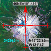
MapTool combines full screen map, GPS, compass, altitude, UTM, Magnetic declination, precision grid and more.
GPS with COMPASS
Both GPS and Compass are displayed on the map with a high precision grid. Accuracy (±) is indicated to check signal quality or magnetic interference.
ALTITUDE
Current altitude is displayed with accuracy (±) in GPS mode.
UTM Coordinates
WGS84/NAD83 UTM coordinates are displayed in real time and in map browsing mode (click Location button).
MGRS and Compass Mils
(click Location button)
MAGNETIC Declination
Current magnetic declination (∆) for the entire world using World Magnetic Model (WMM). A must have feature for those that use a physical compass as well.
MAP Browsing
Map browsing with Latitude/Longitude or UTM coordinates for the entire world.
MAP Grid
High precision grid combined with predefined scale values for both metric and feet/miles (click Scale button)
BATTERY Friendly
Turns off GPS in compass only and browsing modes to improve battery savings
MapTool combines full screen map, GPS, compass, altitude, UTM, Magnetic declination, precision grid and more.
GPS with COMPASS
Both GPS and Compass are displayed on the map with a high precision grid. Accuracy (±) is indicated to check signal quality or magnetic interference.
ALTITUDE
Current altitude is displayed with accuracy (±) in GPS mode.
UTM Coordinates
WGS84/NAD83 UTM coordinates are displayed in real time and in map browsing mode (click Location button).
MGRS and Compass Mils
(click Location button)
MAGNETIC Declination
Current magnetic declination (∆) for the entire world using World Magnetic Model (WMM). A must have feature for those that use a physical compass as well.
MAP Browsing
Map browsing with Latitude/Longitude or UTM coordinates for the entire world.
MAP Grid
High precision grid combined with predefined scale values for both metric and feet/miles (click Scale button)
BATTERY Friendly
Turns off GPS in compass only and browsing modes to improve battery savings
Latest updates
1.3.0